Switzerland has an extraordinary variety of landscapes, ranging from the Central Plateau to the high peaks of the Alps. It is this diversity which makes the country a highly attractive place to live in and do business. As a result of its many different topographic features, types of land use and forms of construction, the territory of Switzerland resembles a jumble of jigsaw pieces.
Urban and spatial development
The Federal Office for Spatial Development ensures the appropriate and economical use of land. In Switzerland, land use is very diverse. One third is given over to agriculture, almost a quarter is made up of urban areas, an additional third is covered by forests, and a further quarter by "unproductive" land like glaciers and rocks.
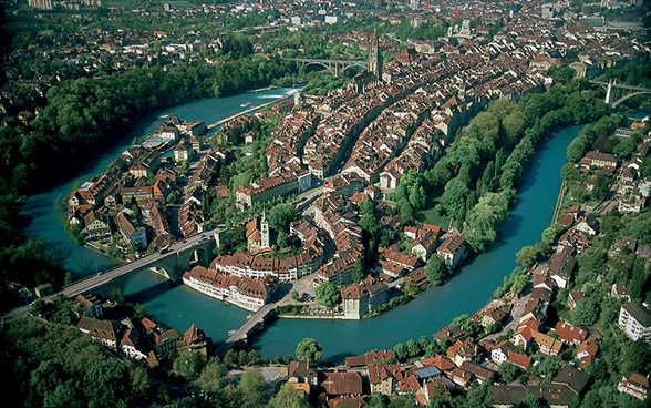
Urban areas
Living, working and recreational activities place demands on settlement areas. Almost three quarters of the Swiss population live in urban areas, and around 80% of the country's economic activity is concentrated there. Half of the urban population live in Switzerland's five largest agglomerations – Zurich, Geneva, Basel, Bern and Lausanne. Although the rate of settlement growth has slowed since the 1980s and 1990s, urban sprawl continues unabated, at the expense of agricultural land.
Agricultural land
Farming accounts for the bulk of land use in Switzerland. Over half of the land in the Central Plateau, the southern side of the Jura and the Pre-Alps in the east of the country is given over to farming. In the mountain cantons, over 90% of agricultural land – natural meadows, grazing farmland and alpine farms – is used for animal production. Nonetheless, agricultural land in Switzerland is shrinking. Around one square metre disappears every second; 80% is lost to settlement areas and the remaining 20% to forests.
Forests
Between 1985 and 2009, forest-covered land grew in Switzerland, particularly in the Alps. The most heavily forested areas are in the Jura, the Rhine Valley not far from Chur, Ticino and the Val Mesolcina. Switzerland’s three largest forests are in Ticino and the Jura. There are few forests in densely populated and intensive farming areas, or in alpine zones where much of the territory is above the tree line.
Natural areas
Switzerland also has natural areas which are used neither for farming or settlement purposes. These are referred to as 'unproductive land' and include areas with no vegetation (44.6%) and glaciers (10.9%). In mountain cantons like Bern, Uri, Glarus, Graubünden and Valais, 60% of their natural areas are unproductive. Lakes and rivers make up more than three-quarters of the natural areas in the Central Plateau, particularly the cantons of Zurich, Zug, Solothurn, Basel-Stadt, Basel-Landschaft, Schaffhausen, Aargau, Thurgau, Vaud, Neuchâtel and Geneva.
Areas of national importance
In the interests of biodiversity and landscape preservation, Switzerland has attributed national importance status to several natural areas. They cover around 23% of the country. Four per cent are strictly protected and their undiminished preservation is mandatory by law. These areas have slightly increased since 1977 due in no small part to the phased introduction of the Federal Inventory of Landscapes and Natural Monuments of National Importance, as well as the application of a 1987 constitutional provision on the protection of moors and wetlands.
Spatial development
One of Switzerland's spatial planning priorities is the densification of the built environment and the preservation of agricultural and undeveloped land. The Confederation, the cantons, cities and communes are working together to devise a nationwide urban planning and development policy.


